Skagaströnd (Sveitarfélagið Skagaströnd)
Skagaströnd, previously Höfðakaupstaður , is a municipality and village in the Northwestern Region of Iceland. It is situated on the western side of the Skagi peninsula, along the east coast of the Húnaflói ('Húna Bay'). The municipality was officially named Sveitarfélagið Skagaströnd on 1 September 2007. Skagaströnd is the only locality within the municipality.
Sveitarfélagið Skagaströnd is bordered to the north and south by the municipality of Skagabyggð and to the east by Sveitarfélagið Skagafjörður. Measuring just 49.4 km2, it is the sixth smallest municipality in Iceland by land area.
The only village within the municipality is the now eponymous village of Skagaströnd, which lies at the foot of the Spákonufell ('Seeress' Mountain'), a culturally significant landmark and the highest point in Sveitarfélagið Skagaströnd, standing 640 m above sea level. On the northwest edge of the village is the Spákonufellshöfði ('Headland of the Spákonufell'), a 22.5 ha nature preserve and park.
The nearest town is Blönduós, 18 km to the south. Road 74, by which Skagaströnd is connected to Route 1, begins at Blönduós' eastern limit. Skagaströnd is situated 32 km as the crow flies east-northeast of Sauðárkrókur, the regional capital of the Northwestern Region; however, due to the rough terrain the journey between the two settlements by road is more than 50 km.
Map - Skagaströnd (Sveitarfélagið Skagaströnd)
Map
Country - Iceland
 |
 |
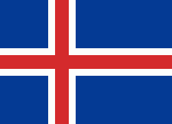
| Flag of Iceland | |
According to the ancient manuscript Landnámabók, the settlement of Iceland began in 874 AD when the Norwegian chieftain Ingólfr Arnarson became the first permanent settler on the island. In the following centuries, Norwegians, and to a lesser extent other Scandinavians, immigrated to Iceland, bringing with them thralls (i.e., slaves or serfs) of Gaelic origin.
Currency / Language
| ISO | Currency | Symbol | Significant figures |
|---|---|---|---|
| ISK | Icelandic króna | kr | 0 |
| ISO | Language |
|---|---|
| DA | Danish language |
| EN | English language |
| DE | German language |
| IS | Icelandic language |
| NO | Norwegian language |
| SV | Swedish language |


